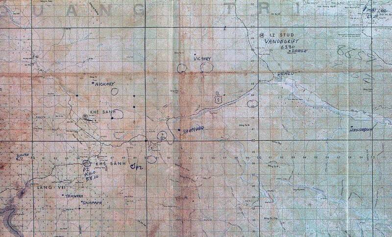
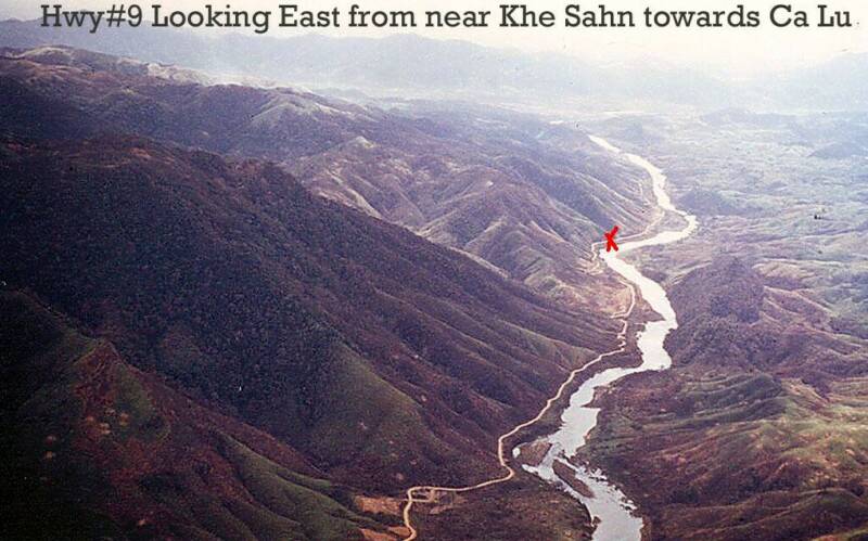
Route #9 is on left side of river, the river runs around Khe Sanh,
Route #9 runs straight through Khe Sanh and into Laos
Map submitted by Maj James Cannon USMC RET
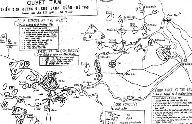
NVA MAP TRANSLATION
NOTE:
The translation starts clockwise with the box at the lower right corner.
Box 1 - Our force at the East:
-320th Infantry Division
-270th Infantry Independent Regiment
-2 Infantry Regiments: 1st & 3rd (part of the former 324th Division)
-1 battalion and 2 companies of Loc Ninh local force.
-The "special force" B5 and 2 companies of Naval "special force" (Seal force??)
-3 Artillery Regiments (84th, 164th, and 209th).
-1 battalion A72
-2 Anti-aircraft Artillery Regiments (128th and 282nd)
-1 Armor/Tank battalion (PT 70) without 1 company.
-The Scouting/Intelligence groups and the Signal groups of B5.
Box 2:
-Our forces
-Enemy
-Destroy those bases
-??? (Could not read very well. Something like "attack the reinforcements")
Box 3 - Enemy at Ta Con Bases:
-C26 and D11C9 American Marine
-D37 Vietnamese Ranger
-24 of 105mm cannons.
-2 Armor/Tank platoons.
Box 4: - Our forces at the West
-2 f (???) Infantry (304th and 325th)
-1 battalion and 1 company of local force
-2 Artillery regiments (675th and 45th)
-1 Anti-Aircraft Artillery regiment (241st)
-1 Armor/Tank battalion (PT 76) without 1 company.
-1 Engineer regiment and 1 Engineer company
-1 Scouting/Intelligence battalion
-1 Signal battalion
-1 Chemical company
-6 Transportation battalions
BOX 1
BOX 4
BOX 3
BOX 2
Map submitted by Maj James Cannon USMC RET
Photo submitted by Paul Marquis
Photo above shows portions of NVA map below.
Map area covers the entire Quang Tri area from the
Laotian border to the mouth of the Cua Viet River.
Bravo Battery Convoy ambushed
near red "X" 4-18-68
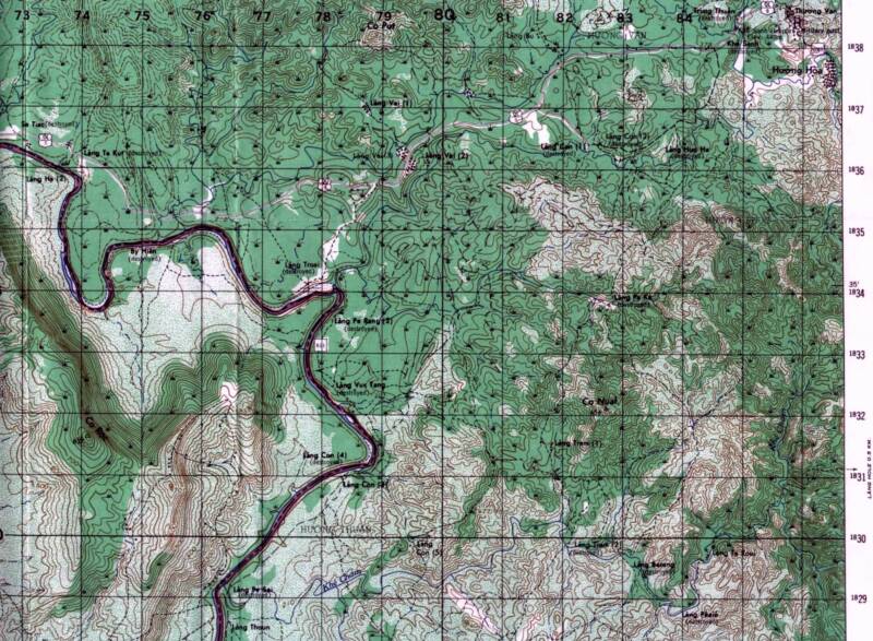
Maps below are of area in photo and NVA Map.
Map submitted by Martin A. Fallgren
Map submitted by Martin A. Fallgren
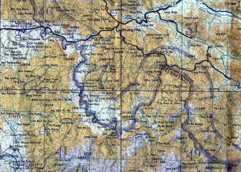
Map submitted by Martin A. Fallgren
Paul Marquis
Web Master

VIETNAM MAPS OF
INTEREST
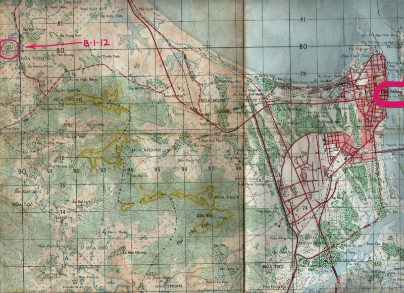
Map submitted by Charlie Payne
I broke out my old maps from 1965 -1966 time frame. In this map were about 15 clicks west of Da Nang, and just a couple clicks north. I managed to scan one of the maps to show both our camp and Da Nang in a single scan. You'll see Da Nang in the upper right, and our camp in the upper left. I believe this was the battery position.
Below the penciled-in B-1-12, you'll see a mountain highlighted in yellow. I did that highlighting while we were there, and I'm pretty sure that was our mountain-top OP. Just the FO team was there.
Helicopter resupply, and only enough water to drink. Took a bath in my helmet cover after a couple weeks. We dug down about 4 feet, and put some logs on top. Had a little cave in it to store C-rations.
Semper Fi!
Charlie